projects
page 1 of 7
ZapMap
Client: Davis-Monthan Air Force Base (DMAFB)
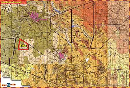
A spin-off from the Briefing Room Interactive (BRI) project. A training aid for A-10 pilots in southern Arizona that presents an interactively zoom-able and drag-able map that is used in conjunction with a SmartBoard (r) digital whiteboard system and a standard web browser.
A note about SmartBoards: These things are cool. You project a computer image on it (via LCD projector) and use it like a mouse. Tapping the board is the same as clicking a mouse. You can draw on it with "electronic" markers (or your finger), as well. Very handy in a training/lecturing situation. Find out more at www.smarttech.com.
Initial View: Southern AZ Flying Area

A map showing the Southern Arizona flying area. Phoenix is the pink splotch in the upper left, Tucson's splotch is in the center about two-thirds of the way down from the top.
The East Tactical range (where pilots drop bombs and shoot guns) is designated by "ETAC" surrounded by red. Clicking on the ETAC range displays a more detailed map of that area...


